


+001v2.jpg)

+057.jpg)
_0271.JPG)
Some Things Are Learned By Experiences Not Found in Any Book
The Northern Lights have seen queer sights, But the queerest they ever did see
(Original Poem by Robert Service)
===> Day 1(Mile 49): Things with Wings
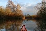
The adventure started out from Whitehorse where shortly after Moose Lee realized that he forgot to bring a razor. On the edge of town, next to the river, there is a Walmart. Since it is 1:00 pm, why not grab a hamburger from McDonald’s as well.
_Day1Composite.jpg) The first major wildlife sighting was a HUGE Bald Eagle rooting in the mud along the shore of an island. So big was this bird that we originally mistook it for a bear.
The first major wildlife sighting was a HUGE Bald Eagle rooting in the mud along the shore of an island. So big was this bird that we originally mistook it for a bear. 
The river had cut through the glacier soil, which is very sandy. We could see that all the mountains have been rounded off by glacial erosion. The mountains around Whitehorse are the result of uplifted coral reefs that have drifted north through the millennium. From a geological standpoint, these mountains are very young and they are still rebounding from the last ice age.
_0037_V2.JPG)
Along the river we came across a very large and colorful Moth which took a liking to Yukon Johann.
_0024_v2.JPG) We spent the night in Steamboat Slough (~Mile 49) at the start of Lake Laberge.
We spent the night in Steamboat Slough (~Mile 49) at the start of Lake Laberge.===> Day 2 (Mile 60): “Have you seen anything strange today…. Like a dead body?”
_0045_v2.JPG)
_0046_v2.JPG)
There are 2 safe ways to progress down Lake Laberge. Paddlers are advised to paddle either the west side or the east side of the lake and stay near the shores for safety reasons as it is a very large and cold lake. We pulled into the Upper Laberge Indian Village near Joe Creek for lunch on the east side.
_0048_v2.JPG)
Later that day we passed the “Eco-Raft” with a group that was filming a documentary on floating a homemade raft to Dawson (more on this story was to come in the following days)
_0053_v2.JPG)
Not too long after, the legendary winds of Lake Leberge began to blow from the SW direction and the rain began. Progress was slow and we were getting wet and cold. We decided to camp at an Indian fish camp with minimal shelter for cooking and a relatively dry place under the trees to setup our tent.
About 9:00 that evening a motorboat with an RCMP came by asking us if we “paddled along the lake today”. He also asked if we “saw anything strange today… like a dead body?”. Of course we had seen nothing of the kind. The inquiry certainly did not lighten the mood for our wet evening. Later that night (12:00 am), along the center of the lake, we saw the Eco-Raft slowly making its way in the rain. It looked like a Ghost ship.
===> Day 3 (Mile 83) : “Damn this lake is long!”
We awoke to hard rain and very damp conditions. A decision was made to go for it and paddle in the hard rain. We packed and headed out with our rain gear on. Surprisingly, we were very dry in the Kayaks and we began to see some progress as we looked across the misty lake to the opposite shore. _0057_v2.JPG)
We passed the Eco-Raft about 3 miles into our paddle. We stopped to chat for a spell and learned about the documentary they were filming in hi-def. They had a motorized support boat which we saw every now and then. _0054_v2.JPG) All-in-all we were in good spirits and Yukon Johann was hanging in there.
All-in-all we were in good spirits and Yukon Johann was hanging in there. _0061_v2.JPG)
We arrived at the end of Lake Leberge about 8:00 pm that evening. It was a long, long, long wet day. We did manage a bit of sun and found a moose jaw at another camp in a brief reprise from the wet. We spent the night on the beach at the head of the 30 mile river. The hull remains of the Steamship Casca #1 could be seen by our tent. The ribs looked like the remains of some ancient dinosaur.
===> Day 4 (Mile 115): Camping among the ruins
This day began a bit wet and got much better. Much, much, better. _0069_v2.JPG) Yukon Johann tried his hand at driving an old truck that was brought in to haul wood from the wood camps for the steamers before we left. From there we began our journey down the 30 mile river. This was perhaps the most incredible stretch of river we have ever paddled. The current was swift and we road many small rapids in our kayaks. We passed such places as U.S. Bend (a near complete circle in the river), the Tanana Reef, the Casca Reef and arrived at Hootalinqua at days end.
Yukon Johann tried his hand at driving an old truck that was brought in to haul wood from the wood camps for the steamers before we left. From there we began our journey down the 30 mile river. This was perhaps the most incredible stretch of river we have ever paddled. The current was swift and we road many small rapids in our kayaks. We passed such places as U.S. Bend (a near complete circle in the river), the Tanana Reef, the Casca Reef and arrived at Hootalinqua at days end.
_0083_v2.JPG)
The area at Hootalinqua was very interesting as it is the site of an old native village and it is where the Teslin river joins the Yukon river. Along the way we had another incredible bald eagle sighting.
_0073_v2.JPG) That night we camped at Hootalinqua island which is a historic site of a steamer shipyard repair facility. We camped just below the ruins of the steamship Evelyn. Although in complete ruins, it still has the boiler and many artifacts.
That night we camped at Hootalinqua island which is a historic site of a steamer shipyard repair facility. We camped just below the ruins of the steamship Evelyn. Although in complete ruins, it still has the boiler and many artifacts. _0091_v2.JPG)
_0106_v2.JPG)
_0094_v2.JPG)
===> Day 5 (Mile 161.5): Caterpillar Buried in Mud at 4th of July
We enjoyed a leisurely day of paddling as the Teslin and Yukon Rivers made for even swifter water than the day before.
We easily made it to the Big Salmon Indian village (where the Big Salmon River joins the Yukon).
_0116_v2.JPG) The natives were preparing for the Salmon runs which start in mid-July (some of these salmon make the journey from the Bering Sea all the way to Whitehorse and the many tributaries of the great Yukon river… many travel a journey of over 2000 miles!). The native cemetery was worth checking out as we could see the remains of many spirit houses in among the graves.
The natives were preparing for the Salmon runs which start in mid-July (some of these salmon make the journey from the Bering Sea all the way to Whitehorse and the many tributaries of the great Yukon river… many travel a journey of over 2000 miles!). The native cemetery was worth checking out as we could see the remains of many spirit houses in among the graves._0115_v2.JPG) After lunch we pressed on and the rain began. Since it was July 4th, we thought it was appropriate that we try and find camp at 4th of July Bend in the Yukon River. No such luck. However, we did find the remains of an old dredge with the Caterpillar motor buried in the silty banks of the river.
After lunch we pressed on and the rain began. Since it was July 4th, we thought it was appropriate that we try and find camp at 4th of July Bend in the Yukon River. No such luck. However, we did find the remains of an old dredge with the Caterpillar motor buried in the silty banks of the river._0118_v2.JPG)
We spent the night at Ericksons Woodyard (Mile 161.5)(Woodyards were like gas stations setup along the river to provide the steamers with wood fuel. They are all abandoned now and there are many artifacts to see).
Yukon Johann had a great campfire going. This picture makes him look like a little fire ghost.
_0133_v2.JPG) We witnessed an incredible sunset at 12:30 am and then off to bed.
We witnessed an incredible sunset at 12:30 am and then off to bed. _0126_v2.JPG)
===> Day 6 (Mile 195): Little Salmon and Taylor’s Cutoff
The next day we paddled to the Little Salmon River and the native village of the same name. The natives were preparing for the pending salmon run. The cemetery was a village of spirit houses. _0134_v2.JPG) We had paddled past 5 mile bend, Selkirk Rock and Grady mountain to get here to Little Salmon for lunch. We paddled though the Columbia slough (site of the Columbia Str wreck) and passed some nifty rock formations with caves high up in the cliffs.
We had paddled past 5 mile bend, Selkirk Rock and Grady mountain to get here to Little Salmon for lunch. We paddled though the Columbia slough (site of the Columbia Str wreck) and passed some nifty rock formations with caves high up in the cliffs.
_0141_v2.JPG)
_0147_v2.JPG)
We spent the night on a nice sandy island at a big bend in the river known as Taylor’s Cutoff (~Mile 195).
_0156_v2.JPG) On this day we noted the support boat for the eco-raft coming towards us and then the engines were shut down… involuntarily. More on this later.
On this day we noted the support boat for the eco-raft coming towards us and then the engines were shut down… involuntarily. More on this later.===> Day 7 (Mile 215): An Oasis In the Wilderness
We traveled to Carmacks and stayed at the Coal Mine Campground. The weather was great and the campground offered real food. We had hamburgers for lunch and dinner with ice cream for desert. We got hot showers and washed our clothes in the camp laundromat. This was the perfect place to relax as it was halfway in our journey and the only place that the road crossed the Yukon river on our journey. The evening highlight was a wonderful rainbow. We enjoyed our day of rest.
_0160_v2.JPG) We were told to keep an eye out for a boat and supplies that hit the bridge piling at Carmacks the day before. This was indeed the boat that we saw the day before shut its engines down. Apparently they crew ran out of gas and were hopeful in getting fuel at Carmacks.
We were told to keep an eye out for a boat and supplies that hit the bridge piling at Carmacks the day before. This was indeed the boat that we saw the day before shut its engines down. Apparently they crew ran out of gas and were hopeful in getting fuel at Carmacks.===> Day 8 (Mile 254): Five Fingers, Rain and Sam McGee’s Ashes
As we left Carmacks this morning, it was raining and it didn’t stop until later that day. We paddled through Shirtwaist Bend, 9 Mile Bend, past Happy Lepage’s Woodcamp and down to the Kellyville Townsite (all overgrown). Our biggest challenge was to survive 5 Finger Rapids (one of only 2 real rapids on the river). The 5 finger rapids were not that bad, but because of the history and number of paddlers that come down the Yukon, it is considered the most hazardous in all of the Yukon Territory. After a couple of bends in the river we came upon the second set of rapids we had been warned about, the Rink Rapids. We had no problem navigating them, in fact Yukon Johann nosed his Kayak into the middle of them and had a nice joy ride. Had it not been raining, we would have had some excellent pictures of this event. We did manage to get pictures of Sam McGee’s ashes (these speculated to be ashes from a volcano eruption in the Wrangell –St-Elias region).
_0169_v2.JPG)
We camped at an old mining camp that night, complete with old cabins at Merrice creek. We saw lots of bear scat. Fortunately, we saw no bears.
_0193_v2.JPG)
===> Day 9 (Mile 297): Forts, Dahl Sheep, Medicine Men and Other Campfire Tales
This day was awesome!! It started with a nice sunrise (if you can call it that) at 4:00 am.
_0175_v2.JPG) It was beautiful!!
It was beautiful!! _0184_v2.JPG)
_0189_v2.JPG)
We found the support boat for the Eco-Raft lying on one of the islands about 5 miles before Mintos. Some folks in a motorboat came by and asked if we seen it.
As the day progressed we saw Dahl sheep on the rocks on Minto Bluff.
Later that day we paddled up Wolverine Creek.
_0216_v2.JPG)
As we approached the Pelly river junction we could see a definitive change in the landscape. Basalt rock formations could be seen. It is believed that this area was the extent of the ice sheets and lava flows came in contact with the massive ice sheets. The Pelly River junction is one of the most beautiful areas of the Yukon river. On the west shore is the site of an old native village and the area where the Canadians built a fort during the gold rush years (Fort Selkirk).
_0283_v2.JPG)
_0263_v2.JPG) The alpenglow and subsequent sunset at 12:30 am were incredible.
The alpenglow and subsequent sunset at 12:30 am were incredible. _0282_v2.JPG) It was a trip back in time as there were artifacts from the ancient native villages intermingled with the old gold rush cabins and buildings.
It was a trip back in time as there were artifacts from the ancient native villages intermingled with the old gold rush cabins and buildings. _0236_v2.JPG)
_0238_v2.JPG)
The evening campfire was filled with tales, stories and life lessons from a real native medicine man. It was fantastic. He goes by the name of “Papa Don” but his native name, which we cannot pronounce, is Porcupine.
_0229_v2.JPG) We should’ve stayed another day. It was an incredible place that we will never forget. It is as remote of village as you will find in the Yukon. Accessible only by the river.
We should’ve stayed another day. It was an incredible place that we will never forget. It is as remote of village as you will find in the Yukon. Accessible only by the river._0257_v2.JPG)
===> Day 10 (Mile 329) : Bugs!!
We reluctantly left Fort Selkirk and headed past places called Victoria Rock, Black Creek, Twin Falls, Threeway Channel (sounds kinky), Seventeen Mile Creek, Holbrook Creek, Push Button Bend, Pilot Island, etc… until we reached the Selwyn River. Along the way we did see some incredible rock formations. Rock that was cooled really fast as it butted up against the ice sheets. We did see some more Dahl sheep up in the cliffs along the river. None were ever close enough for a good picture though.
We camped at Menzies location.
It was a pretty uneventful day, except for the bugs!! They were horrible. The worst we’ve experienced on our trip so far. The tent was covered in flys. It was unbelievable. We did meet up with some really nice folks from Saskatchewan.
===> Day 11 (Mile 374): Wolves, Moose and Steak Sandwiches
We saw 4 moose on this day.
_0317_v2.JPG)
Wolf Tracks?
_0297_v2.JPG) Wolf Tracks (?) and old boat buried in the silty mud.
Wolf Tracks (?) and old boat buried in the silty mud. _0300_v2.JPG)
We paddled a whooping 45 miles to arrive at Kirkman Creek. The local residents there, the Taylors, have baked goods for sale and offered steak sandwiches and chili for dinner. We enjoyed grilled steak sandwiches, homemade Rootbeer, Salad and homemade bread. Yeah, we were sure "roughing it" that night, eh?
===> Day 12 (417): Island Camping
Another wet day of paddling as we paddled past Carlise Creek, Thistle creek, Flanagan’s Slough and on to where the White River joins the Yukon. At this point, the river became a milky white soup. Filtering water was impossible from this point on. We passed Becker’s island, Frisco Creek and Shamrock Creek and onto where the Stewart River joins the Yukon. We paddled passed Split-Up Island and Stewart Island. It was rainy and wet. The water was like a thick milk chocolate color. We could hear the silt scraping along the bottoms of our boats. We paddled late into the evening and when the sun came out, we camped on a small island near Deadman Island and heard one or two wolves howling on the west bank of the river in the late evening hours. It was spectacular!
_0330_v2.JPG)
_0332_v2.JPG)
===> Day13 (Mile 455): So? There are Bears on this Island… Let’s Make a Big Fire
This day was pretty uneventful. We had a nice lunch at a gravel bar.
_0339_v2.JPG)
We spent our last night on 12 mile island (an old woodyard from back in the steamer days). After checking carefully for signs of bear on the island we deemed it safe to make camp.
_0371_v2.JPG)
Unfortunately we missed a set and we discovered them after dinner. They looked to be a few days old and we were camped way out on the gravel bar. Surely we'd be safe :-)
_0367_v2.JPG)
Just to be sure we built one of the largest fires ever and danced around it like John Dunbar in "Dances With Wolves" late into the night.
_0372.JPG)
_0376_v2.JPG)
===> Day14 (Mile 467): Dawson City
We pulled off the river, tired and hungry after finally seeing some crystal clear water from the Klondike river making its way into the Yukon River. We made it to Dawson. What a memorable trip. We will be back to paddle some of the other rivers. There many life times of exploring to do up here in this vast, unspoiled wilderness.
_0386_v2.JPG) So there you have it. A summary of our 500 mile Yukon River float trip. There is not room for many of the details here, but rest assured, this post will be updated over time to fill in additional holes. We met a few memorable people (2 Gals From St Louis), some very nice Candians (Thanks Vic!) and some native 1st Nations people. It is by far, the most incredible paddle trip we've ever taken. I'd dare even say, it was even the best adventure trip in our lives. We will be back for more... someday.
So there you have it. A summary of our 500 mile Yukon River float trip. There is not room for many of the details here, but rest assured, this post will be updated over time to fill in additional holes. We met a few memorable people (2 Gals From St Louis), some very nice Candians (Thanks Vic!) and some native 1st Nations people. It is by far, the most incredible paddle trip we've ever taken. I'd dare even say, it was even the best adventure trip in our lives. We will be back for more... someday. -Enjoy "Moose" Lee & "Yukon" Johann
